Hitchin
Hitchin Race Circuit
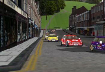
Hitchin Race Circuit is a photo-realistic 3D model of the town centre and some of the other streets that can be played as a computer racing game. (Like Formula 1 racing at Monaco, Silverstone etc) Download it and race against friends or against others online. It’s absolute fun to play a computer game and see Hitchin also. Some buildings are now gone and others have changed hands, so added local history too. Find it here http://www.hitchin-circuit.co.uk/ and enjoy.
The Archaeology of Hitchin
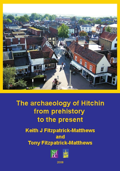
On the 10th of May 2008, a book about the archaeology of Hitchin is being released and there will be a launch on the lawn in front of the Hitchin Museum at 12.00pm (courtesy of The Hitchin Historical Society). It’s a ‘must have’ book about Hitchin and is somewhat of a ‘bodice ripper’ when it comes to archaeology. The authors will be signing copies of the book (they don’t bite) beforehand and will be giving a brief talk about it.
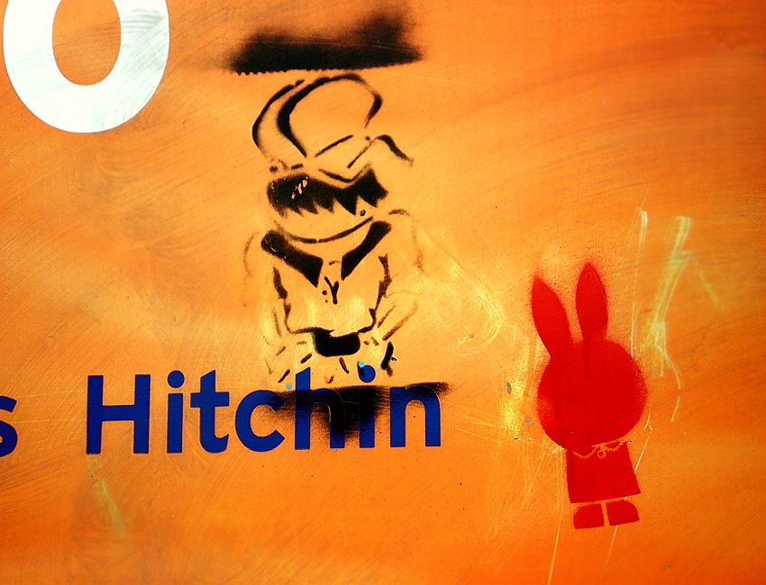
Hitchin Sainsbury’s
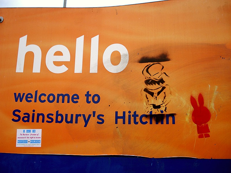
A welcome to Sainsbury’s Hitchin sign just off Winbush Road at the back entrance to Sainsbury’s shop used to have some little bits of graffiti on it. Shame that the top and bottom of the template that the person used spoiled the left figure by overspraying it, but at least it’s different from the usual ‘spray your name’ tag lines that graffiti sprayers usually do. This no longer exists as it was washed off. At least I managed to photograph and catalogue this bit of Hitcin’s social history before it disappeared and was forgotten.
God’s House in Hitchin
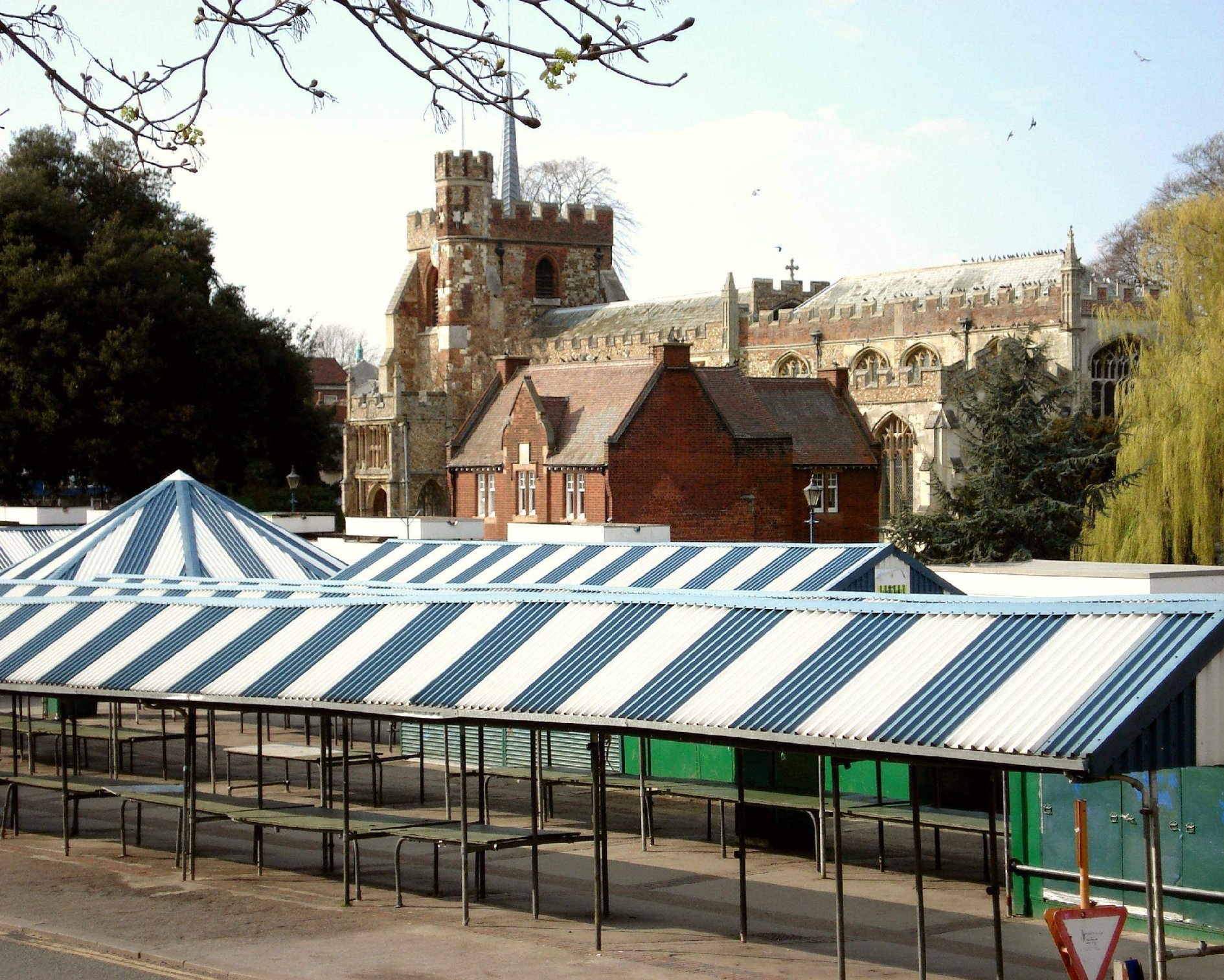
I took this photograph one day on the way to work early in the morning. It’s as if the church were overlooking and protecting the Warner’s Alms Houses and the market. The usual view is usually taken from wonderful The Triangle Cafe across to the War Memorial and the church’s porch and tower. (A pretty view but it makes the church seem isolated and to do with death rather than with living and life) This was taken from Biggin Lane by The Biggin, through the market across to the church. It was strange to see no one in the market or teenagers hanging around, drinking alcohol as usual. A nice gentle, serene start to the day.
Recycling Hitchin
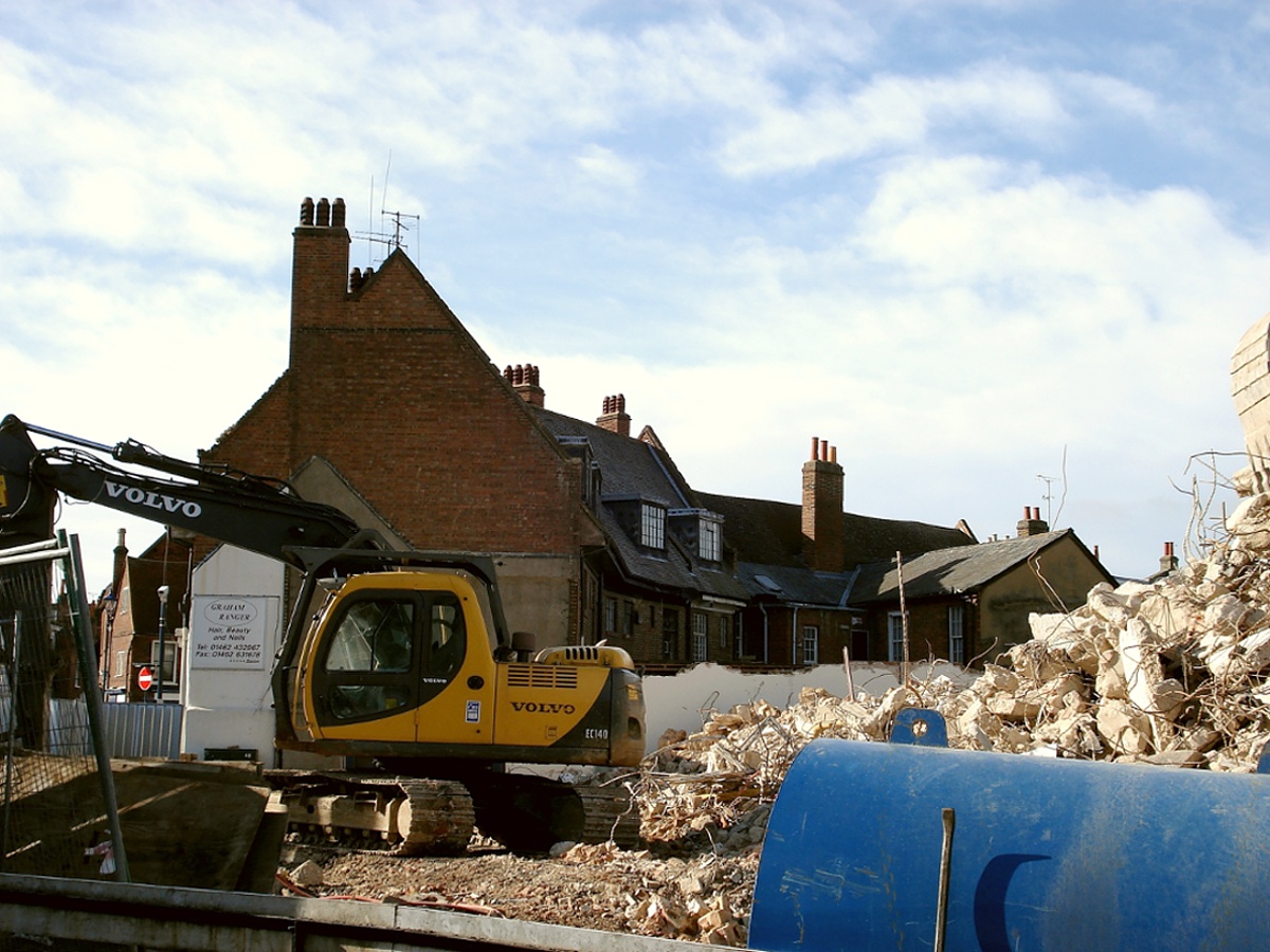
In the 1950s, the largely derelict and overgrown late 17th century building that was the former Lucas’s Brewery on Bridge Street (that closed in 1923) was demolished to make way for the vile and unloved concrete monstrosity that was the Tax Office known as ‘Crown House’. Demolition has now taken place to knock it down to make way for another development. What has been good to see, has been the recycling of the materials that made up the building. Metals and concrete etc, pulverised and re-used elsewhere. Hopefully the new development will be more in fitting with the existing characters of the surrounding buildings. (probably more expensive apartments no doubt)
Dry River Hiz
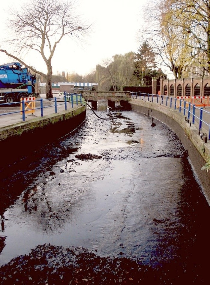
Not so long ago, part of The River Hiz became dry. Quite thrilling as one never sees that happen often, and funny, because its name means ‘Dry’. Sicca (Pronounced Sicka) in Brittonic (The language of Britain at the time of the Romans, later becoming Welsh) becomes ‘Hicce’ (Pronounced Hiche) under the Anglo-Saxons and later it was named ‘Hiz‘ (Pronounced Hits) by the Normans who couldn’t pronounce it. Modern day Hitchin obviously gets its name from the river and its peoples the ‘Hicce’. The River’s name is now pronounced as it’s spelled.
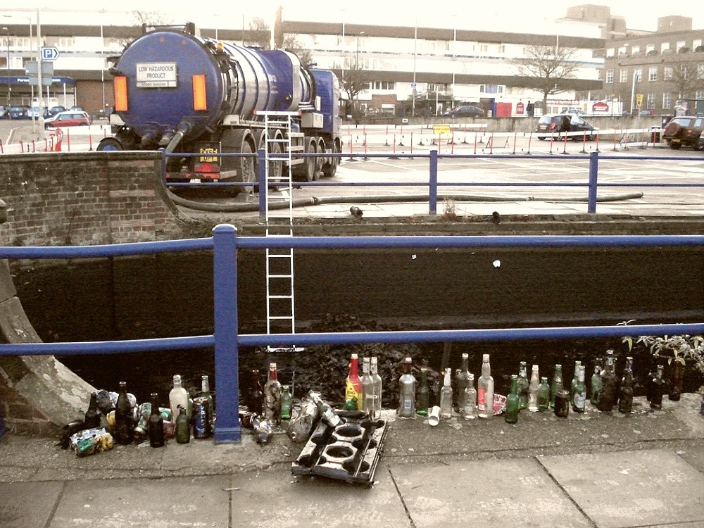
Part of the river became dry once the very shallow canalised bit between The Biggin on Biggin Lane and Portmill Lane Car Park on Portmill Lane was emptied. This seems to happen twice a year to clear it of leaves and rubbish. Large tankers called ‘Honeywagons‘ (Manure collectors) come down and suck out all the gunge and workmen scrape out all the leaves and rubbish. (Usually bottles galore from being thrown in at the time of ‘The Rhythms Of The World’ festival.) If it were an Archaeological Dig, it would be great to find so many artefacts that can be reliably dated by the bottles’ often well publicised styles, in one place; But because it’s cleaned out every year, then sequences of layers can’t build up and a much longer history can’t be observed. Shame for the archaeology but good for the town’s prettiness.
Hermitage Road and Windmill Hill
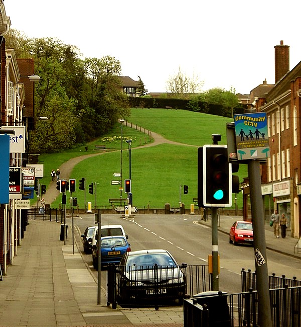
This photograph is taken on Windmill Hill looking down toward Hermitage Road. The two are linked by the wealthy quaker banker called Frederic Seebohm who had a large house on Bancroft, known as the Hermitage. He gave part of his back garden to form Hermitage Road in 1875. (Roughly the same time the windmill on Rawlings Hill burnt down) He aquired the land and built the Hitchin Girls’ Grammar School in 1907 and then his two daughers donated the rest of the hill to the people of Hitchin in 1921.
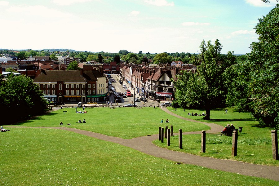
The photograph here is of Windmill Hill looking up from Hermitage Road. Originally called Rawlings Hill, because of the Mill there, it was then known as Windmill Hill after if burnt down as mentioned above. The miller’s cottage was still standing on the Hollow Lane side of the hill until 1950; and there was a house built on the hill in the 1920’s, but was unpopular and is no longer there. The two photographs illustrate quite well I think, just how green the centre of Hitchin is.
Bridge Street Bridge

Bridge Street in Hitchin takes its name from the bridge itself, crossing the River Hiz, that was built in 1784 and rebuilt in 2001. ‘Bridgefoot‘ is also mentioned in a survey dated from 1676. At one end of Bridge Street is ‘The Triangle’ (because of a triangular bit of land that had a tree with railings around it) and the other end leads to The Priory and Tilehouse Street.
Earlier on in Hitchin’s Medieval history, the road was known as Spital or Spittle Street as it led to Spital Field that had a Hospital on it. (Spital being a contraction of Hospital)
